Visualize incidents instantly and guide responders along the fastest route with live mapping and detailed floor plans.
Get Started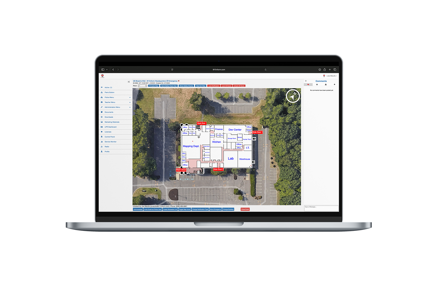
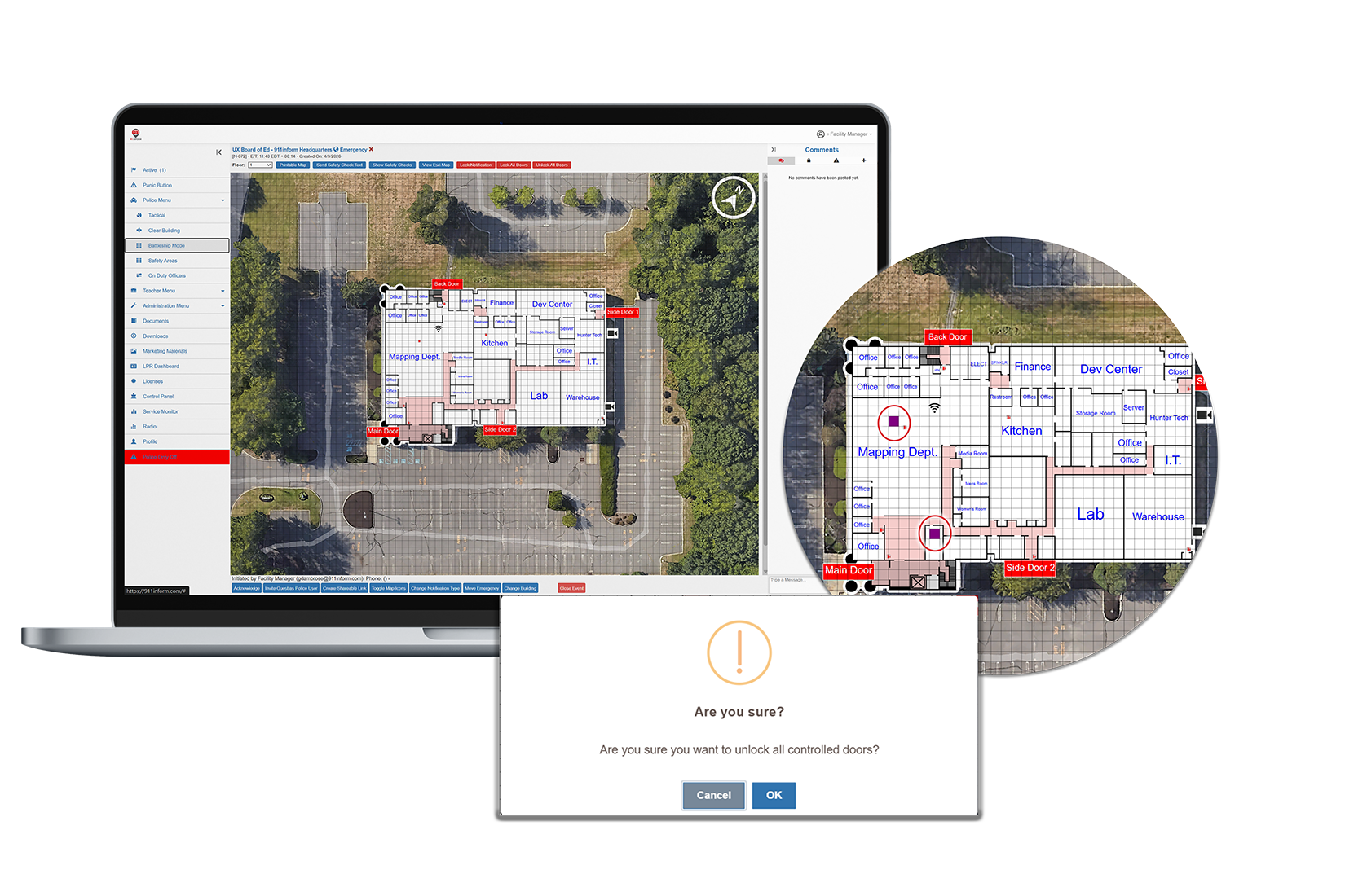
911inform’s Interactive Mapping transforms static floor plans into real-time operational intelligence, giving on-site teams and first responders a clear, live view of every emergency as it unfolds.
With precise indoor location, integrated systems, and guided response, users can see exactly where an incident is happening, access critical assets, and navigate the fastest path to respond, instantly and with confidence.


Keep up-to-date user location information readily available to emergency dispatchers
911inform is the only all-encompassing platform to help emergency response teams better manage communication and connected-building controls directly related to an emergency. Our solution provides emergency notifications to dispatch, first responders and key building personnel seconds after a 911 emergency phone call is placed within a 911inform geofenced building location. Our software is activated, through PBX phone or smartphone, and provides an emergency notification to all required parties, as well as the exact location (within 3 meters of accuracy) of the emergency event location. We then hand the connected-building controls to dispatch and emergency response teams, allowing them to use the video surveillance feeds, voice control systems and door access capabilities directly related to the emergency, ensuring that they can arrive on scene as quickly as possible and be better prepared when they do.